Great Smoky Mountains National Park is the reason we all fell for this place — and it's right at the bottom of our mountain. The Wears Valley entrance is only about 10–15 minutes from Tippity Top, so you can be standing in old-growth forest or beside a rushing creek before your coffee's even cold. It's also the most-visited national park in the country by a wide margin — and, wonderfully, it's free to enter.
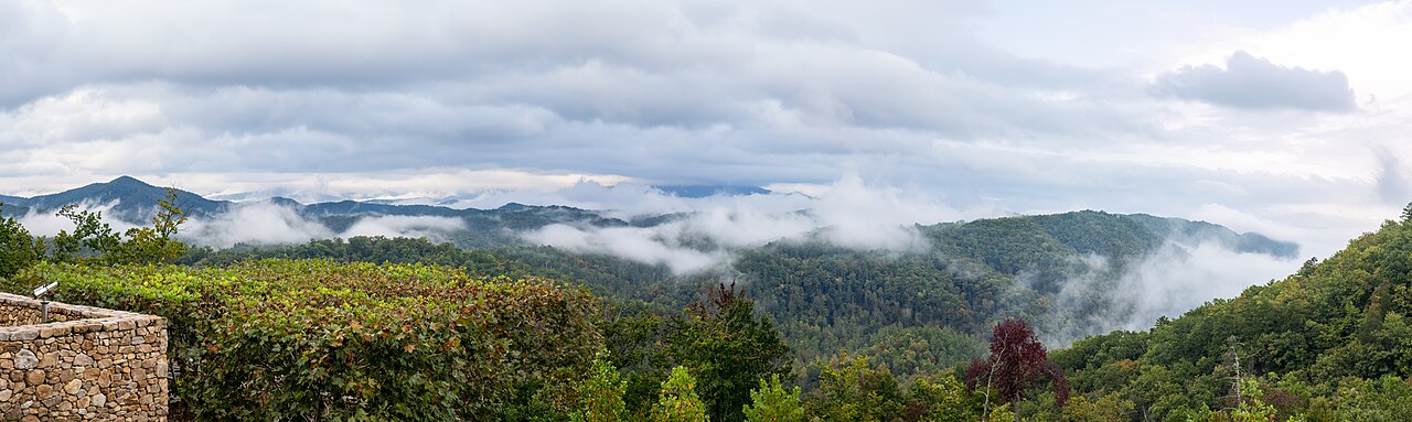
The park straddles the Tennessee–North Carolina line and protects more than 500,000 acres of misty ridgelines, waterfalls, wildflowers, and some of the oldest mountains on Earth. It's a UNESCO World Heritage Site and an International Biosphere Reserve, home to an astonishing variety of life — over 19,000 documented species (and likely thousands more undiscovered), including black bears, elk, and more kinds of salamander than anywhere else on the planet. There are roughly 850 miles of trails, about 70 of them part of the Appalachian Trail running right along the spine of the range.
A little history
These mountains are the ancestral homeland of the Cherokee, who have lived here since time immemorial — the park's highest peak was recently restored to its Cherokee name, Kuwohi (“mulberry place”), long known as Clingmans Dome. By the early 1900s, intensive logging was rapidly clearing the old forests, and a grassroots movement of locals, schoolchildren, and philanthropists (with a major gift from John D. Rockefeller Jr.) raised the money to buy the land piece by piece. The park was officially established in 1934 and dedicated by President Franklin D. Roosevelt in 1940. Scattered through the coves you can still visit the preserved cabins, churches, and grist mills of the Appalachian families who once farmed here.
Top 10 things to do
- Cades Cove — an 11-mile loop through a broad valley ringed by peaks; the park's best spot for bears and deer, plus historic cabins and churches. Go early. (~40–50 min from the cabin)
- Newfound Gap & the overlook — the scenic drive over the crest of the Smokies, straddling the state line, with big views and an Appalachian Trail crossing. (~45 min)
- Kuwohi (Clingmans Dome) — the park's highest point at 6,643 ft; a steep paved half-mile leads to a spaceship-like observation tower and a 360° sea of ridgelines. (~1 hr)
- Roaring Fork Motor Nature Trail — a narrow one-way loop past rushing streams, mossy boulders, and old cabins, near Gatlinburg. (~30 min)
- Alum Cave Trail — a park favorite past Arch Rock and Inspiration Point (a great moderate turnaround, or push on to Mount LeConte). (~40 min)
- Chase a waterfall — Grotto Falls (you can walk behind it!), Rainbow Falls, or Abrams Falls in Cades Cove. See our Hiking trails page.
- Sugarlands Visitor Center — exhibits, a park film, rangers, and the gateway near Gatlinburg; a great first stop for maps. (~25–30 min)
- Wildflowers in spring — the Smokies are the “wildflower national park,” and April–May is spectacular.
- Fall color — October turns the whole range gold and crimson; it's magnificent (and busy).
- Ranger programs & dark skies — junior-ranger activities for kids, and some of the darkest skies in the East after sunset.
5 off-the-beaten-path picks
- Metcalf Bottoms — a peaceful riverside picnic area just 15 minutes away, with an easy walk to the Little Greenbrier Schoolhouse and the historic Walker Sisters cabin.
- The Foothills Parkway — an uncrowded ridgetop drive with some of the most jaw-dropping panoramas in the region, minus the traffic.
- Greenbrier — a quiet, creek-laced area near Gatlinburg that locals love for swimming holes and the Porters Creek wildflower walk.
- Tremont — a gravel-road valley along the Middle Prong with gentle riverside trails and the short, punchy Spruce Flats Falls hike behind the Tremont Institute.
- Cataloochee Valley — the far (NC) side of the park and a longer drive, but the place to reliably see elk at dawn or dusk in a gorgeous, remote cove.
Parking passes (Park It Forward)
Entry to the park is free, but since 2023 every vehicle parked for more than 15 minutes needs a parking tag displayed on the dash:
You can also buy tags in person at kiosks around the park (Metcalf Bottoms, Sugarlands, Newfound Gap, the Townsend Wye, and more) — but printing at the cabin first saves you the hassle.